By: Fidelis Zvomuya
“Rather than look upstream in anger, we must start looking downstream with compassion,” said 79-year-old Mafiosi Siabwanda, a Tonga elder from Mola in the Nyaminyami District of Kariba, Zimbabwe. He admitted that human activities happening upstream in1 the Zambezi River are having devastating impacts downstream.
“The situation is dire,” he said. “Millions of people in the basin are barely surviving in the space between malnutrition and death.”
On a recent visit to the Kariba Dam, he explained. “Not a drop came out of the dam’s sluices. Rocky patches on the riverbed lay exposed, and sections of the dam’s walls, that are normally submerged, were exposed and discolored. The rains had come late to the basin this previous season, and in small quantities. Though recent strong rains up north in Zambia have given the people some hope,” he says.
According to Siabwanda, one of the worst recorded droughts in human history has stretched water supplies thin across the far-reaching river basin, which is home to about 32 million people. “The people of the basin don’t need scientists to tell them that they live in one of the world’s driest areas in the center of the planet’s most water-poor region,” he added.
Recent studies carried out by several organisations suggest the basin, whose population is growing fast, is being hit particularly hard by climate change, getting hotter and drier than previously anticipated. Despite relief from recent rains, the problem is only expected to get worse. One forecast predicts the region will receive as much as 30% less rain by 2100.
The Zambezi River, and its dense network of tributaries and associated wetland ecosystems, constitutes one of southern Africa’s most important natural resources. The wetlands represent some of the most productive ecosystems in the drainage basin in that they provide freshwater for human consumption and economic development, forage for livestock and fertile soils for crop production.
The basin yield critically important harvest of fish protein and support some of the largest contiguous wildlife populations and habitats on the African continent. At the same time, it provides for the majority of the region’s present power generation. It also represents key asset in the region’s tourism and recreation industry and supports the subsistence economies of some of the most unique communities of southern Africa.
Zambezi’s long journey
The Zambezi River, the fourth-longest river in Africa, flows for 2,574 km.It flows from Mwinilunga, a town in the northwestern province of Zambia, past a few cities, winding through remote, rust-colored canyons and touching six states before entering the Indian Ocean. It’s a natural wonder, but also a life source for those who live in its basin.
For generations, the river has provided water for people, animals and agriculture. Millions of people depend on the vitality of the Zambezi River, includingfloodplains and delta. These are highly productive and biologically diverse ecosystems, fed by seasonal floods. They have played a crucial role in shaping culture and driving local and regional economies for centuries within the basin.
A vital lifeline in a rain-poor region, the river’s annual floods both fertilize and water crops in the riverbank gardens of subsistence farmers. The floods nourish grazing lands along the river as well, supporting livestock and small-time herders.
Residents depend on the vitality of the river’s wetlands, whose outputs of fish, cattle and crops such as maize are directly proportional to the flood extent. Moreover, during the dry season, wetlands become a magnet for pastoralists, and act as a buffer against droughts for very large areas of the region.
As its flow has dwindled, thanks to climate change and dams, the river basin’s productivity is under threat.
A basin in trouble
Challenges in the Zambezi Basin vary from lack of access to water despite the abundance of it in the vicinity, to droughts, floods, and animal and human conflict. The region lacks development initiatives to help communities adapt and remain resilient in the face of the various shocks and stresses.
More recent projections, cited by the Intergovernmental Panel on Climate Change, indicate that the Zambezi River Basin will experience still drier and more prolonged droughts and even bigger floods in years to come.
For people in the basin who dependent on agriculture, drought conditions increase the likelihood of sustained conflict, especially among the poorest communities.
“We are really in trouble if we don’t take action in time,” said Siabwanda, a former senior extension officer with the Zimbabwe department of agriculture. “Continuing to conserve water is not going to be enough. Hope for rain is not a plan.”
Climate change is increasingly expected to drive water shortages in the future. Scientists predict the shifts will include increasingly frequent droughts, and more evaporation due to higher temperatures. And this would follow a long period that may, if anything, have had higher-than-normal precipitation.
“Virtually all the climate models suggest there will be a reduction of inflows in the river. It could be 10 to 30%,” said Isaac Mackenzie, Kariba constituent member of parliament. “It’s not a problem you can cavalierly say, ‘We will worry about this in 20 to 30 years.'”
“Climate change is water change. The two go hand in hand,” Mackenzie said. “Heat drives the water cycle.”
Mackenzie said many people in the basin make a living from small-scale farming, and the area normally receives sporadic rainfall.
Livelihoods in the basin rely mainly on rainfed agriculture, except in the extreme dry north. Low yields and water productivity result from low inputs, short growing seasons, dry spells, and excessive water use.
Within the Zambezi basin, some 15.4% of the total land surface is under some form of formal, commercial irrigated and rainfed, as well as small-scale agriculture, whilst approximately 71% is “open land.”
Floods have also been highly destructive to infrastructure, transportation, and the flow of goods and services.
Dams
When a river is regulated for the purpose of producing hydroelectric power, the downstream ecological effects are usually severe. Occasionally, regulation results in the extinction of species.
The Zambezi delta is particularly at risk. It is one of the most productive areas in one of the world’s poorest countries. The delta includes 230 kilometers of coastline fronting 18,000 square kilometers of swamps, floodplains, and even savannahs. The area has long been prized by subsistence fishermen and farmers, who find fertile ground for crops like sugar and fertile waters for prawns and fish. Two species of endangered cranes and one of the largest concentration of buffalo in Africa among many other species of wildlife have found a haven in this internationally recognized wetland.
Dams can be disastrous for the millions of people downstream who depend on wetlands for their livelihoods. Currently, 13,000 megawatts of new large-dam hydropower is proposed for the Zambezi and its tributaries. An in-depth study, commissioned by International Rivers and written by Dr. Richard Beilfuss, assesses the hydrological risks for hydropower dams on the Zambezi River and gives an early warning about what Southern Africa could be facing as it contemplates plans for more large hydropower dams in a time of climate change.
Despite these damaging consequences for wetlands and people, more dams are earmarked for the Zambezi Basin. The region’s governments do have options, however. Wind and solar are becoming competitive, and they cause far less social and environmental damage than dams. And dams are particularly ill-suited to climate change, which simultaneously requires that they be larger to accommodate the anticipated floods and smaller to be cost-effective during the anticipated droughts.
Flood recession farming
Ninety-five percent of the rural labour force in the basin are smallholder farmers mainly involved in dryland crop production, but often owning some livestock. Farmers living near the river bank traditionally hold two portions of land, one in the river bed or floodplain margin and the other some distance away, beyond the floodplain. Plots close to the river are used for flood recession farming, especially in the dry season. Both annual and perennial crops are cultivated.
Much of the lower Zambezi Valley is well suited to livestock production and grazing activity is closely linked to flooding. Traditionally, livestock were herded along the river banks, where they found the best pasture and water supply, and were moved progressively onto the floodplain as the flood waters receded. The availability of good-quality pasture in the late dry season is especially important, and depends upon prolonged flooding during the wet season.
In the vicinity of Mpanda Nkuwa, the semi-arid climate and associated vegetation favour cattle and goats, but pigs, poultry (mainly chickens and ducks) and, to a lesser extent, donkeys are also kept. Cattle, in particular, play an important role in the social system wealth and social prestige and as a vital source of draught power for crop production.
But dams have interrupted those natural floods, holding the waters back. The construction of the two major dams, Kariba and Cahora Bassa, has reduced the water flow and led to a number of problems.
According to Dr. Richard Beilfuss at the International Crane Foundation, the Zambezi farmers have seen a reduced area for flood recession crops, which is linked to 30% decline in productivity.
It has also affected animals and people in the Lower Zambezi region. Some animals have been forced to migrate to other places. The water reduction has also forced many people to adopt to new ways of life and survival.
Fishing
Commercial fisheries make up another important aspect of the Zambezi River Basin economy. Communities by the Zambezi river fish extensively from it, and many people travel from far afield to fish. Some Zambian towns on roads leading to the river levy unofficial “fish taxes” on people taking Zambezi fish to other parts of the country. As well as fishing for food, game fishing is a significant activity on some parts of the river. Between Mongu and Livingstone, several safari lodges cater to tourists who want to fish for exotic species, and many also catch fish to sell to aquaria, according to the New World Encyclopedia.
The Lake Cahora Bassa and the Kariba Dam are known for their kapenta fishing rigs, and large populations of cichlids, catfish and tiger fish are fished heavily for food. But the dams have also had negative’ effects on fisheries. When the Cahora Bassa Dam was constructed in 1973, its managers allowed it to fill in a single flood season, going against recommendations to fill over at least two years. The drastic reduction in the flow of the river led to a 40% reduction in the coverage of mangroves, greatly increased erosion of the coastal region, and a 60% reduction in the catch of prawns off the mouth due to the reduction in emplacement of silt and its associated nutrients. Wetland ecosystems downstream of the dam shrank considerably, the New World Encyclopedia added.
The wide, shallow shelf outside the mouth of the Zambezi River, known as the Sofala Bank is a rich fishing area. The industrial shrimp fishery that takes place currently provides the most important sources of foreign currency for Mozambique.
Fishing also plays an important part in the Lower Zambezi riverine economy. Near Tete, some 15-20% of the population engages in fishing to supplement the household diet and, sometimes, income. These are mainly subsistence farmers who fish with rod and line or traps. Domestic utensils and pieces of cloth are also used to catch fish in pools as the floods recede. A few fishermen are full-time artisans who fish with canoes and gill nets, or with beach seines.
Zambezi River Basin E-Flows Project
The Zambezi River is the heart of Mozambique, pumping life into one of the most productive and biologically diverse tropical floodplains in Africa.
As the region contemplates its future, it must not just look to other energy sources, but also other river management schemes. The concept of “environmental flows” recognizes that rivers have a pulse, a flood and drought regime that species have relied on for eons. Where possible, these historic flows must be restored, or mimicked, to maintain the river’s health. The Zambezi River Basin Joint Environmental Flows Program began in 2010, and it set the precedent for technical collaboration on the project. The initial phase of the project is aimed at identifying ecological, economic and social indicators that are strongly correlated to environmental flows. The priority focus areas are Kafue Flats and the Zambezi Delta, in Zambia and Mozambique respectively.
The project is aimed at setting up a monitoring framework in the Zambezi River Basin to investigate the effects of environmental flows on ecological, economic and social parameters. The indicators first need to be identified and partner institutions that can assist will need to be approached and dialogue continued. But, in a region facing a severe water shortage that could affect millions, it’s a first step.
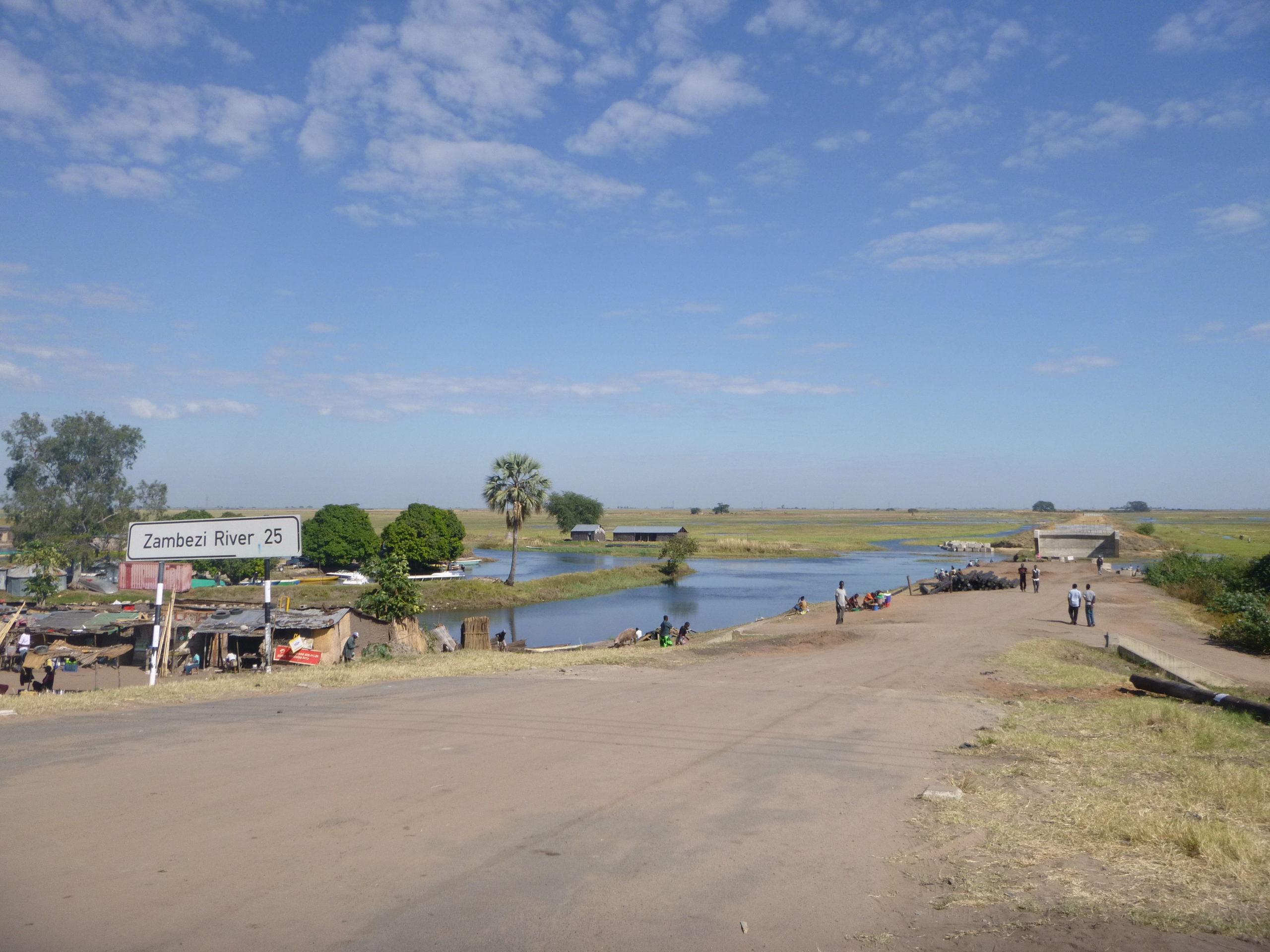
Featured image: Where Mongu and the Zambezi floodplain meet – 25 kilometers from the river’s main channel | Photo by Peace Corps.